Dettagli
Anno di pubblicazione
1680
Luogo di stampa
Amsterdam
Descrizione
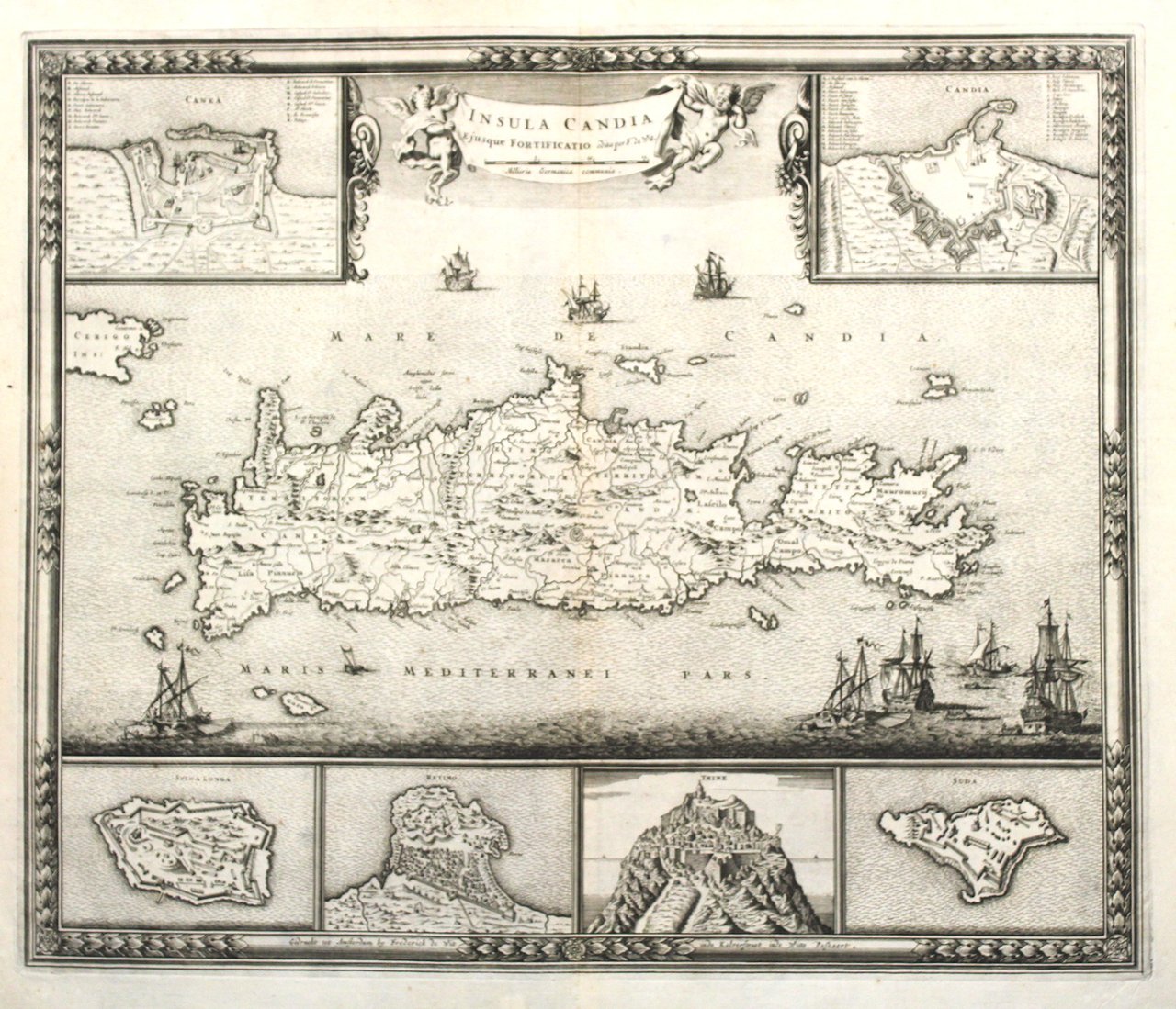
Incisione in rame, mm 470x555, firmata in basso nella cornice "Gedruckt tot Amsterdam by Frederick de Wit inde Kalverstraat inde Witte Paskaert ". Elegante cartiglio figurato al centro. Due riquadri in alto e quattro in basso raffiguranti fortezze e città dell'isola: Canea, Candia, Spina Longa, Retimno, Thine e Suda. La carta si basa su quella di Sebastien de Pontault de Beaulieu, che qualche anno prima eseguì numerosei disegni di fortezze del mediterraneo. Tratta da "Atlas sive Descriptio Terrarum Orbis". De Wit fu uno dei più noti cartografi della seconda metà del '600; acquistò molte lastre da Blaeu e Jansonius, producendo molti atlanti. Splendido esemplare in ottimo stato di conservazione eccettuata una traccia di tarlo nei margini laterali. <BR>Map of Crete with six insets showing the fortifications of Canea, Candia Spina Longa, Retimo, Thine and Suda. Based on the cartography of Sebastien de Pontault de Beaulieu, who mapped a lot of Mediterranean fortifications approx. anno 1674. On the map a lot of informations of roads, towns and topography.<BR><BR>Copper engraving, mm 470x555. Six insets with plans of Canea/ Chania, Candia/Iralkion, Spina Longa, Retimo, Thine and Suda. decorative banner title held by two cherubs at top and nice bordure. It is based on the cartography of Sebastien de Pontault de Beaulieu, who mapped a lot of Mediterranean fortifications approx. anno 1674. Dark Impression, very good conditio except some minor worming in outer margins. From "Atlas sive Descriptio Terrarum Orbis".<BR>De Wit was one of the most prominent and successful map engravers and publishers in Amsterdam in the period following the decline of the Blaeu and Jansson establishments, from which he acquired many copper plates when they were dispersed at auction.<BR>His output covered most aspects of map making: sea charts, world atlases, an atlas of the Netherlands, 'town books' covering plans of towns and cities in the Netherlands and Europe, and wall maps.<BR>Frederick de Wit was born in Gouda near Amsterdam in 1648 and by 1654 he had opened a printing office and shop under the name "De Drie Crabben" (the Three Crabs) which was also the name of his house on the Kalverstraat. In 1655, De Wit changed the name of his shop to the "Witte Pascaert" (the White Chart). Under this name De Wit and his firm became internationally known.<BR>Dating De Wit's atlases and maps is considered difficult because usually no dates were recorded on the maps and their dates of publication extended over many years<BR>Zacharakis:3714/2392. <BR>

Scopri come utilizzare
Scopri come utilizzare
