Questo sito usa cookie di analytics per raccogliere dati in forma aggregata e cookie di terze parti per migliorare l'esperienza utente.
Leggi l'Informativa Cookie Policy completa.

Stampe

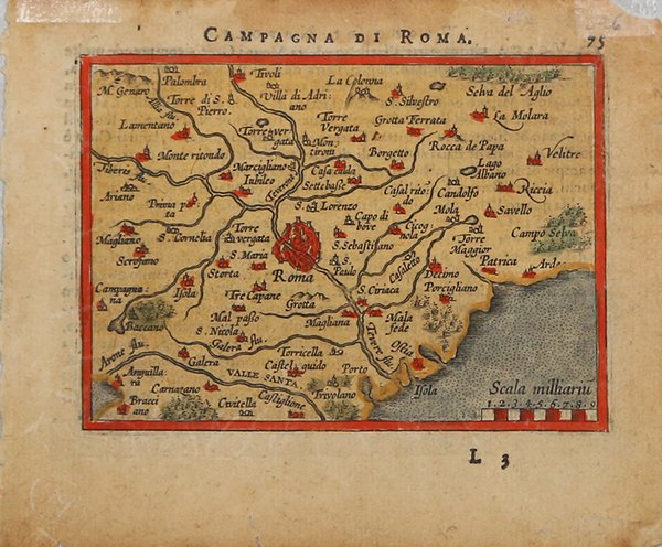
GALLE Abraham ORTELIUS - Philip

Campagna di Roma

1583

150,00 €

Antiquarius Libreria

(Roma, Italia)

Parla con il Libraio

Metodi di Pagamento

Dettagli

Anno di pubblicazione
1583
Luogo di stampa
Anversa
Formato
105 X 75
Incisori
GALLE Abraham ORTELIUS - Philip
Descrizione
Koeman: Ortelius 61, G. King, Miniature Antique Maps, pp. 64-65.

Descrizione

Carta geografica tratta dal "Epitome theatri Orteliani" di Abraham Ortelius. Sei anni dopo la sua prima versione di mappe per l'edizione tascabile dell'Epitome di Ortelius (1577), Philip Galle realizza una seconda serie di tavole che pubblica per la prima volta nel 1583. Tra il 1583 ed il 1593 l'Epitome di Galle fu stampata in più lingue, con titoli diversi.Queste lastre furono poi acquisite da Jan Baptiste Vrients, tra il 1598 e il 1601, il quale corregge le lastre, modificandole o reincidendole, apportando diversi cambiamenti alle mappe e rendendole perciò simili ma differenti a quelle pubblicate nelle precedenti edizioni dell'atlante tascabile.Incisione in rame, finemente colorata a mano, in buono stato di conservazione. Miniature map from the "Epitome thatri Orteliani" by Philippe Galle."Over fifteen years, Philip Galle gradually engraved a second series of miniature plates for his pocket Ortelius atlas and for the most part these have very short titles in capital letters, quite different from the first set. "ey are also altogether plainer and clearer, with less detail and decoration and may be easily distinguished from the first series (see 1577), as they all have plain double-line borders too. "e first eleven were new maps which he introduced in 1583. A further eleven followed in 1585/88 and during the next decade Galle engraved more new ones, till there were fifty one by his final edition of 1598.It is often said that this second series was much better engraved than the first, but in reality they were just drawn in a more plain and less crowded style: it was the way they were drawn that changed.Between 1598 and 1601, Jan B. Vrients acquired the plates and published the last editions of the atlas in 1601 and 1602, with both new and revised plates". [cfr. G. King, Miniature Antique Maps, pp. 64-65].Copperplate, fine later hand colour, some waterstain at left margin, generally in good conditions. Cfr. Koeman: Ortelius 61, G. King, Miniature Antique Maps, pp. 64-65.
Logo Maremagnum it