Questo sito usa cookie di analytics per raccogliere dati in forma aggregata e cookie di terze parti per migliorare l'esperienza utente.
Leggi l'Informativa Cookie Policy completa.

Stampe

CLUVER Philipp

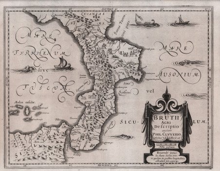
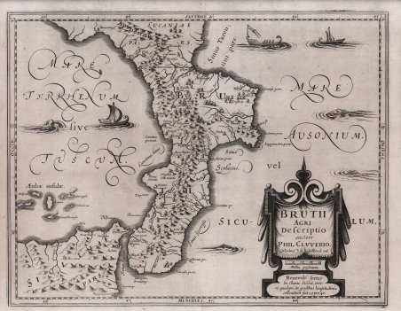
Brutii Agri Descriptio auctore Phil Cluverio

1624

400,00 €

Antiquarius Libreria

(Roma, Italia)

Parla con il Libraio

Metodi di Pagamento

Dettagli

Anno di pubblicazione
1624
Luogo di stampa
Leida
Formato
360 X 285
Incisori
CLUVER Philipp

Descrizione

Carta storico geografica tratta da Italia Antiqua di Philipp Cluver (1580-1623) - noto anche con il nome latinizzato in Cluverius e quello di Cluverio in italiano - geografo tedesco e fondatore della geografia storica. Tra il 1607 e il 1610 viaggiò attraverso varie regioni europee, toccando l’Inghilterra, la Germania, la Francia e l’Italia, dove fece un ulteriore viaggio tra il 1616 ed il 1618. La celebre opera conobbe una prima edizione nel 1624 a Leida, con le mappe incise da Nicolas van Geelkercken (1585-1656). Dell’opera del Cluver sono note numerose ristampe sia a Leida che in altre città europee; tutte comprendono mappe basate sulle originali del Geelkercken, ma incise da altri artisti. Esemplare dalla prima edizione dell’opera (1624) con le mappe incise da Geelkercken. Nicolas van Geelkercken, una delle figure meno conosciute dell’età aurea della cartografia olandese, fu attivo come incisore, cartografo ed editore a Leida, Amsterdam e Arnhem. Più tardi sarebbe diventato l'agrimensore della Gheldria. Acquaforte, in ottimo stato di conservazione. Historical-geographical map taken from the ' Italia Antiqua ' by Philipp Cluver (1580-1623) - also known by the Latin name Cluverius and the Italian name Cluverio - German geographer and founder of historical geography. Between 1607 and 1610 he traveled through various European regions, touching England, Germany, France and Italy, where he made a further journey between 1616 and 1618. The famous work had a first edition in 1624 in Leiden, with maps engraved by Nicolas van Geelkercken (1585-1656). Numerous reprints of Cluver's work are known both in Leiden and in other European cities; all of them include maps based on Geelkercken's originals, but engraved by other artists. Nicolas van Geelkercken, one of the lesser-known figures of the highly productive Dutch period at the beginning of the seventeenth century, was active as an engraver, cartographer and publisher in Leiden, Amsterdam and Arnhem. He was later to become the Surveyor of Gelderland. Etching, in excellent condition. Cfr.
Logo Maremagnum it