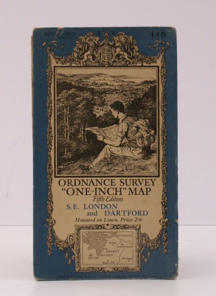
Ordnance Survey One-Inch Map. Fifth Edition. SE London and Dartford. Mounted on Linen. Sheet 15. [Ellis Martin cover].
Ordnance Survey One-Inch Map. Fifth Edition. SE London and Dartford. Mounted on Linen. Sheet 15. [Ellis Martin cover]. | Libri antichi e moderni | Ordnance Survey
Libri antichi e moderni
Ordnance Survey
Ordnance Survey, [Southampton,
1935
18,40 €
(Devon,
Regno Unito)
Metodi di Pagamento
- PayPal
- Carta di Credito
- Bonifico Bancario
- Pubblica amministrazione
- Carta del Docente
Dettagli
- Anno di pubblicazione
- 1935
- Autore
- Ordnance Survey
- Editori
- Ordnance Survey, [Southampton
- Soggetto
- topography, se london, dartford, os, ordnance survey, maps, ordnance survey, topography, maps, ordnance, survey, one-inch, map
- Lingue
- Inglese
Descrizione
Folding coloured map on linen measuring 22.0 x 28.5 ins (approx. 56.0 x 72.0 cms) folding in 21 panels to 7.5 x 4.25 ins (approx. 19.0 x 11.0 cms); a very good, bright, clean copy. The famous One Inch Fifth Edition series was first published in 1934 with striking 'younger sitting hiker' artwork by Ellis Martin. The present copy is the 1935 revision; the covers are the blue and black variant with location map. Browne, 11.2.unrecorded.
