Libri antichi e moderni
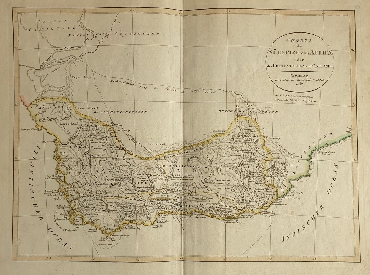
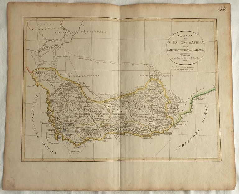
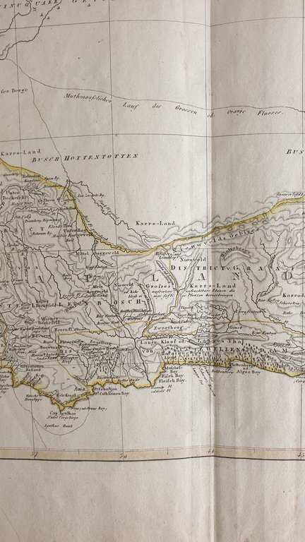
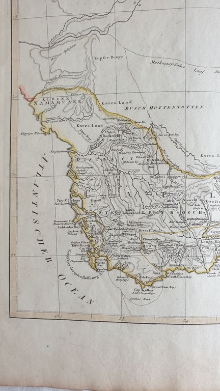
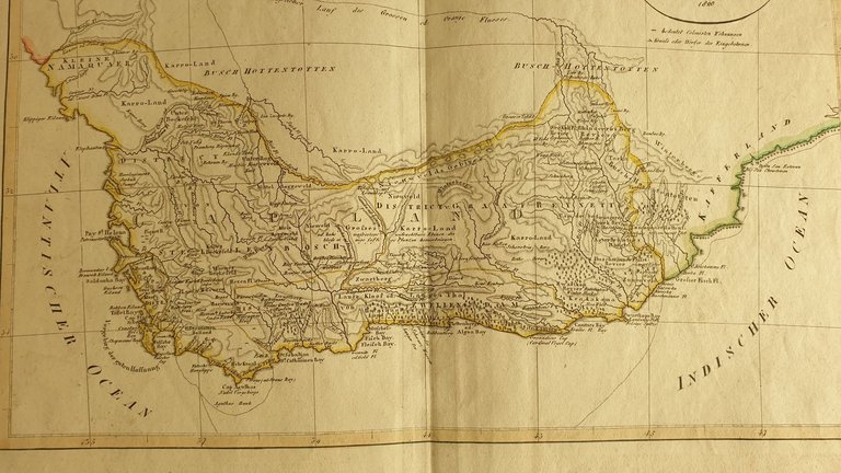
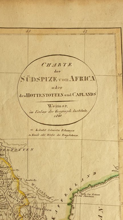
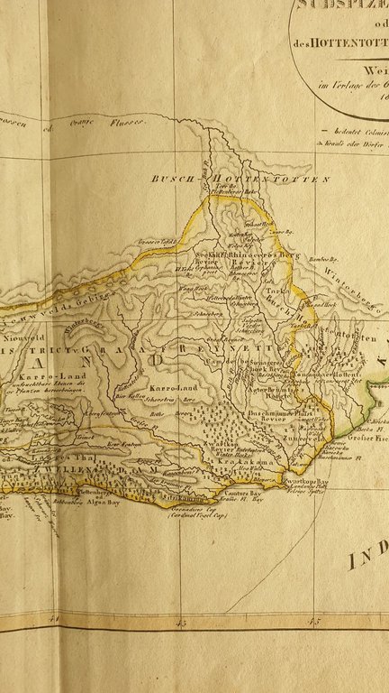
CHARTE DER SUDSPIZE VON AFRICA O DES HOTTENTOTTEN AND CAPLANDS WEIMAR IM VERLAG DES GEOGRAPH. INSTITUTS 1820
1820
300,00 €
Sephora Libreria
(Foligno, Italia)
Le corrette spese di spedizione vengono calcolate una volta inserito l’indirizzo di spedizione durante la creazione dell’ordine. A discrezione del Venditore sono disponibili una o più modalità di consegna: Standard, Express, Economy, Ritiro in negozio.
Condizioni di spedizione della Libreria:
Per prodotti con prezzo superiore a 300€ è possibile richiedere un piano rateale a Maremagnum. È possibile effettuare il pagamento con Carta del Docente, 18App, Pubblica Amministrazione.
I tempi di evasione sono stimati in base ai tempi di spedizione della libreria e di consegna da parte del vettore. In caso di fermo doganale, si potrebbero verificare dei ritardi nella consegna. Gli eventuali oneri doganali sono a carico del destinatario.
Clicca per maggiori informazioniMetodi di Pagamento
- PayPal
- Carta di Credito
- Bonifico Bancario
-

-
 Scopri come utilizzare
il tuo bonus Carta del Docente -
 Scopri come utilizzare
il tuo bonus 18App