Détails
Description
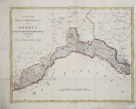
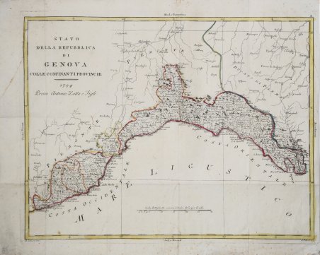
Rara variante – priva del cartiglio in alto a sinistra e con data 1794 - della carta geografica pubblicata nell’Atlante novissimo, illustrato ed accresciuto sulle osservazioni e scoperte fatte dai più celebri e più recenti geografi che riporta la data 1782 all’interno del cartiglio con il titolo posto in alto a sinistra. La carta viene realizzata mediante la stessa lastra, abrasa nella parte superiore sinistra, dove compare alche un nuovo titolo. La carta è tratta da Geografia storico politica d’Italia, opera in 6 volumi pubblicata nel 1795 e arricchita da alcune carte dell’Atlante Novissimo, debitamente modificate nella data. ' L’Atlante Novissimo è fra i più belli e completi mai pubblicati in Italia nel XVIII secolo - stampato in quattro volumi da Antonio Zatta tra il 1779 ed il 1785 – e rappresenta l'opera più famosa dello Zatta. L’Atlante Novissimo, come si specifica anche nel titolo, è “accresciuto sulle osservazioni scoperte fatte dai più celebri e più recenti geografi”. Tra le novità più significative vi è la comparsa delle nuove isole scoperte nell'Oceano Pacifico da James Cook e la prima carta italiana della Nuova Zelanda. Le illustrazioni furono ' ideate e disegnate dai suoi collaboratori Giovanni Marco Pitteri, Anton Friedrich Busching, Pietro Antonio Novelli ed incise da Giuliano Zuliani. Il primo tomo dell’atlante è introdotto da un breve saggio di geografia generale dove l’autore definisce in modo sintetico e preciso gli elementi che compongono i reticoli eclittico ed equatoriale usati nelle tavole. Interessante la sezione dove si sofferma ' a descrivere il fenomeno della precessione degli equinozi e quello della variazione ciclica dell'obliquità dell'eclittica. Acquaforte, stampata su carta vergata coeva, coloritura coeva dei contorni, in buone condizioni. Rare variant - without the cartouche in the upper left corner and with the date 1794 - of the map published in the Atlante novissimo, illustrato ed accresciuto sulle osservazioni e scoperte fatte dai più celebri e più recenti geografi that shows the date 1782 inside the cartouche with the title placed in the upper left corner. The map is made from the same plate, abraded in the upper left, where there is also a new title. The map is taken from Geografia storico politica d'Italia, a work in 6 volumes published in 1795 and enriched by some maps of the Atlante Novissimo, duly modified in date. The ' Atlante Novissimo, as also specified in the title, is “increased on the observations made by the most famous and most recent geographers”. Among the most significant innovations there is the appearance of the new islands discovered in the Pacific Ocean by James Cook and the first Italian map of New Zealand. The illustrations were designed and drawn by his collaborators Giovanni Marco Pitteri, Anton Friedrich Busching, Pietro Antonio Novelli and engraved by Giuliano Zuliani. The first volume of the atlas is introduced by a brief essay of general geography where the author defines in a concise and precise way the elements that make up the ecliptic and equatorial grids used in the tables. Interesting is the section where he pauses to describe the phenomenon of precession of the equinoxes and the cyclical variation of the obliquity of the ecliptic. Etching, printed on contemporary laid paper, contemporary outline coloring, in good condition. Cfr.


Découvrez comment utiliser
Découvrez comment utiliser

