Détails
Graveurs
MONALDINI Venanzio (attivo 1765 - 1829 circa)
Thème
Piante e Panorami di Roma, Maps and General Views of Rome, Roma, Roma
Description
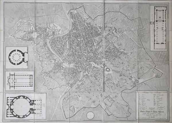
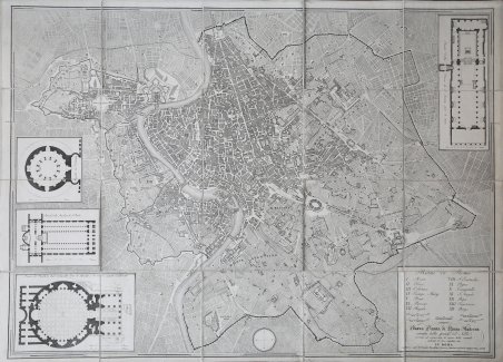
Pianta della città di Roma basata sulla mappa di Giovanni Battista Nolli (1692-1756). Incisione di Pietro Ruga. Con una legenda (I - XIV), scala e titolo "Nuova pianta di Roma moderna estratta dalla grande del Nolli: nell'angolo in basso a destra, corretta ed accresciuta de 'nomi delle contrade indicate al loro rispettivo sito".Include 4 piani inserti del Pantheon, della basilica di San Paolo, del mausoleo di Santa Costanza e della chiesa di San Lorenzo.Si tratta della prima edizione della pianta che il Ruga disegnò ed incise per l'editore Venanzio Monaldini, il cui successo e diffusione è testimoniato dal fatto che venne ristampata in successive sei edizioni fino al 1843. Sul lato destro sono raffigurate le piante del Mausoleo di Santa Costanza, Basilica di San Paolo e Panthon; in alto a destra San Lorenzo fuori le mura. IN basso a destra, sopra al titolo, è inciso l'elenco dei 14 Rioni. Nella pianta, assai dettagliata, da notare l'emiciclo di Piazza del Popolo realizzato solo per metà.Incisione in rame, in 20 sezioni posate su lino e più volte ripiegate, racchiuse in astuccio in cartonato coevo. Ottime condizioni. //// Town plan of Rome based on map by Giovanni Battista Nolli, ( fl. 1692-1756). Engraved by Pietro Ruga. With a key (I - XIV), scale and text "Nuova pianta di Roma moderna estratta dalla grande del Nolli : corretta ed accresciuta de' nomi delle contrade indicati al loro rispettivo sito", in lower right corner.Includes 4 inset plans of the Pantheon, St. Paul's basilica, the mausoleum of St. Costanza and the church of San Lorenzo.Dissected in 20 sections and laid on linen, as issued. Fine condition.A fine and rare 1843 case format map of Rome, Italy by Venanzio Monaldini. This extraordinary map of Rome heavily references, with various updates and revisions, the seminal 1734 map of Rome by Giovanni Battista Nolli. Nolli’s map was the first modern map of Rome and basis of almost all subsequent maps of Rome until approximately 1870, when Rome became the capitol of Italy and more modern plans were issued. Depicts the city in extraordinary detail labeling all streets, ferry crossings, bridges, parks, and historic buildings. Surrounded by plans of important buildings including the Mausoleum of Saint Constance, the Basilica of St. Paul, a layout of the Pantheon, and the floor of the Church of Saint Lorenzo. This map was designed with the traveler in mind and thus bisected and backed with linen for easy folding. Comes with original slipcase. Most likely engraved by Pietro Ruga, a prominent Rome based engraver best known for his architectural plans and views. Published from Venanzio Monaldini’s bookshop on 79 Piaza di Spagna, Rome, Italy. Marigliani, Le Piante di Roma nelle collezioni private, p. 307, n. 233. Scaccia Scarafoni p. 258.

 Découvrez comment utiliser
 Découvrez comment utiliser