Détails
Graveurs
OTTENS REINER & JOSHUA
Description
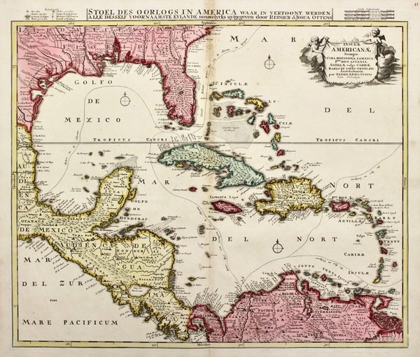
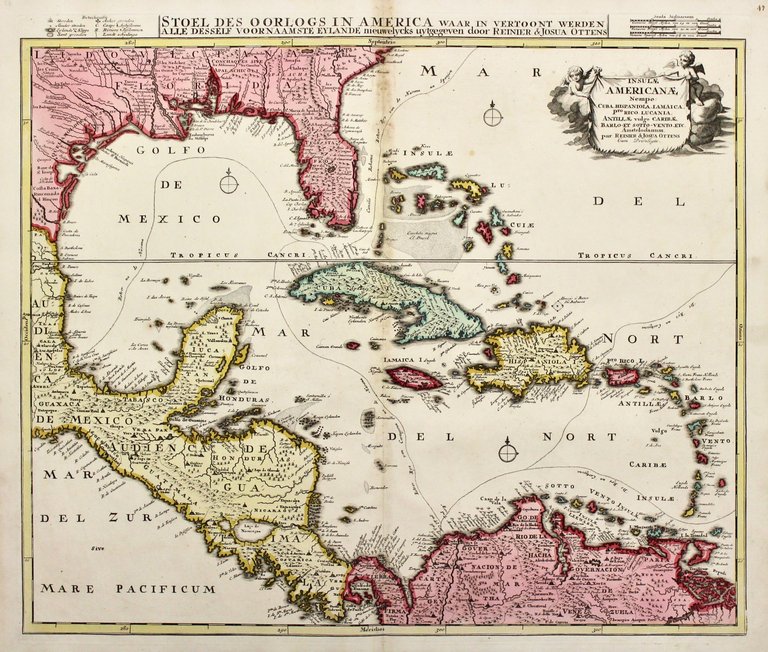
Copper engraving, mm 500x590, original colour. Very good condition with minor foxing at upper centerfold<BR>A rare re-issue of the plate by Danckerts showing prominently in the center Cuba, Haiti, the Bahamas and Florida, which is here marked in the map as the province 'Tegesta'. In Florida, or Florida Hispanica as it is labeled here, the peninsula is called Tegesta Prov. The province of Tegesta is a Dutch convention pioneered by Hessel Gerritz, hydrographer to the Dutch East India Company and the Dutch West India Company, and Johannes de Laet. It refers to the Tegesta people, an indigenous group active near what is today Miami-Dade. The Tegesta were one of the first groups to meet Europeans, specifically the conquistadores Ponce de Leòn and Pedro Menéndez de Avilés.<BR>It was originally made to illustrate the theater of the Nine Years' War (1688-1697), one of the many inter-imperial conflicts of this period. The map was again relevant as a theater of war because the European power were again at each others' throats over the power of the Hapsburg Monarchy. The war had actually started in 1739 in the Caribbean as the War of Jenkins Ear, when hostilities over illicit trade between the British and the Spanish led to Britain declaring war in 1739. Vice-Admiral Edward Vernon sacked Portobello at the end of that year. The war was later subsumed into the larger War of Austrian Succession, which had significant battles in the Caribbean. Route of the Spanish gold and silver fleets shown.<BR>Included is the Bahamas Channel route to Havana, the route from Veracruz to Havana, Havana to Cartagena, and Cartagena to Spain. The Spanish Empire operated a closed trading system, only allowing Spanish vessels to dock at and trade with ports in their colonies. The arrival of the galleon annually or semi-annually was a major event in the port cities, triggering fairs and festivities. <BR>In the right upper corner is a beautiful uncoloured title cartouche held by two putties. The map has a second title in Dutch along the upper part "Stoel des Oorlogs in America waar in vertoont werden alle desself voornaamste Eylande nieuwelycks uytgegeven door Reinier & Josua Ottens." with a mileage scale and table of explanations on either side.<BR>Joachim Ottens (1663 - 1719) and his sons Renier and Joshua were prominent Dutch booksellers and map publishers from about 1680 to 1790. Joachim, the founder of the firm, was initially employed as a copperplate engraver by Frederick de Wit. In 1711 Joachim founded his own firm. Though Joachim died only a few years later, his sons Renier and Joshua took over the firm and presided over its most prolific period <BR><BR>


Découvrez comment utiliser
Découvrez comment utiliser
