Détails
Description
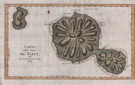
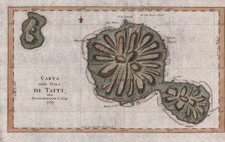
Edizione italiana della celebre carta dell’isola di Tahiti di James Cook. La presente carta è stata stampata come parte del resoconto ufficiale del primo viaggio di Cook, che fu curato dal critico letterario John Hawkesworth e sottoscritto dall'Ammiragliato britannico. An Account of the Voyages undertaken by the order of His Present Majesty for making Discoveries in the Southern Hemisphere. (Londra: W. Strahan and T. Cadell, 1773) raccontava i viaggi non solo di Cook, ma anche di Byron, Wallis e Carteret che si erano avventurati nel Pacifico per la Royal Navy in precedenza negli anni 1760. ' James Cook, fu nominato luogotenente al comando dell'Endeavour, un vascello di 370 tonnellate, salpò da Plymouth il 25 agosto 1768, conducendo seco J. Banks, il botanico Solander, e i pittori Buchan e Sydney Parkinson, l'ultimo dei quali acquistò fama per i suoi quadri d'interesse naturalistico. Dopo aver toccato Madera e Rio de Janeiro, doppiò il Capo di Buona Speranza e giunse nell'aprile del 1769 a Tahiti; riconobbe e rilevò l'arcipelago delle Isole della Società e, portata a termine la missione affidatagli, navigò verso SO., compiendo quasi per intero il periplo della Nuova Zelanda, dove scoprì lo stretto che da lui prese nome. Colpito dal fatto che, nonostante Tahiti fosse comunque uno scalo di estrema importanza per le navi che solcavano il Pacifico, la posizione segnata sulle carte risultava terribilmente approssimativa, Cook approfitta della sosta per calcolare anche latitudine e longitudine esatte dell’Isola, destinate ad arricchire e migliorare le attuali mappe nautiche che risultano sempre incomplete e notevolmente indeterminate. È il 13 luglio 1769 quando Cook dà ordine di salpare l’ancora, navigando sulla rotta prestabilita che dovrebbe portarlo verso Sud scopre altre isole facenti parti dell’Arcipelago di Tahiti alle quali conferisce il nome di Isole della Società, in onore appunto alla Royal Society. Acquaforte, finemente colorata a mano, in ottimo stato di conservazione. Italian edition of the map of Tahiti by James Cook. Captain James Cook (1728-1779) is considered to be the greatest explorer of the eighteenth century and was the finest maritime cartographer of the Age of Enlightenment. Having first worked on coal colliers and then distinguished himself as a surveyor in Eastern Canada, in 1768 he became the British Admiralty's choice to lead an unprecedented voyage of discovery. The central impetus for the expedition was to observe the Transit of Venus from Tahiti and then to proceed to explore ' Terra Australis Incognita, the supposedly rich southern continent. Whereas the first part of the voyage was to be conducted under the auspices of international scientific cooperation, the second part was entirely clandestine and was only communicated to Cook via "Secret Instructions" to be opened once at sea. Cook's party left Plymouth in August 1768 aboard the converted coal collier ' HMS Endeavor ' and proceeded to Tahiti by way of Cape Horn. They arrived in time to observe the Transit of Venus, which occurred June 3, 1769. Cook then proceeded towards New Zealand, to the coordinates recorded by Tasman. ' ' The present chart was printed as part of the official account of Cook's first voyage, which was edited by the literary critic John Hawkesworth and underwritten by the British Admiralty. An Account of the Voyages undertaken by the order of His Present Majesty for making Discoveries in the Southern Hemisphere… (London: W. Strahan and T. Cadell, 1773) recounted the voyages not only of Cook, but of Byron, Wallis, and Carteret who had also ventured to the Pacific for the Royal Navy earlier in the 1760s. Etching with fine later hand colour, good condition. Cfr.


Découvrez comment utiliser
Découvrez comment utiliser

