Détails
Graveurs
JANSSONIUS JOHANNES
Thème
Gran Bretagna, Britannia
Description
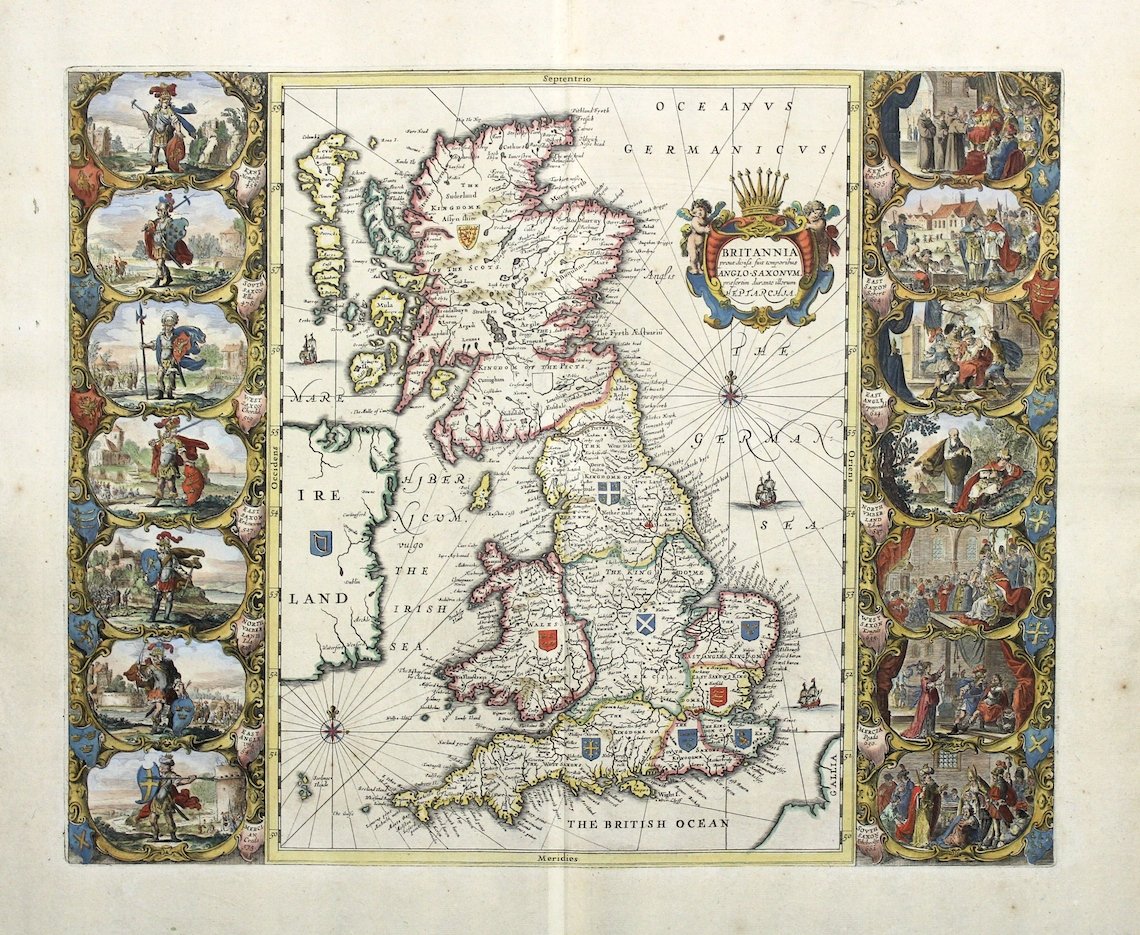
Incisione in rame, dipinta a mano, mm 420x520. <BR>Una fra le più decorative carte delle isole britanniche che raffigura il regno sassone in Britannia a cavallo fra il V e il VI secolo. La carta è praticamente una copia di quella di Blaeu pubblicata nel 1645, da cui si differenzia per l'aggiunta di navi e rose dei venti. Blaeu a sua volta aveva preso spunto dalla carta di Speed del 1611 ridisegnando in stile olandese del XVII secolo le vignette a carattere storico poste ai due lati della carta. La carta fu prima inserita nel volume del mondo antico (vol. VI) dell'Atlas Major di Janszoon e poi in "Accuratissimia Orbis Antiqui Delineatio" col testo di G. Hornius, stampato come volume singolo.<BR>Ottime condizioni, bella coloritura.<BR>Janssonius, genero di Jodocus Hondius e cognato di Henricus Hondius, figlio di Jodocus, collaborò alla pubblicazione di atlanti, dopo l'acquisizione delle lastre di Mercatore da parte di Jodocus e dal 1638 fu in effetti colui che guidò l'impresa editoriale, mentre Henricus Hondius lentamente abbandonava l'attività (dal 1646 il suo nome non apparirà più su alcun frontespizio); divenne così il grande avversario della famiglia Blaeu nel secolo d'oro della cartografia olandese. <BR>Georg Horn fu un erudito tedesco, autore di numerose opere storiche, fra cui anche del testo per l'atalnte storico di Janssonius. Copper engraving, mm 420x520, colored. Among the most decorative maps of the British Isles, showing the Saxon Kingdoms of Britain in the 5th to 6th Centuries<BR>The so called Heptarchy map is drawn after Joan Blaeu's one of 1645, which is based on 1611 Speed's map. It bears the same title of Blaeu's but vessels, rumb lines and compass roses has been added in the sea. The two sets of vignettes on either side of the map show historical scenes of the Saxon age, also copied from Speed's map but redone in dutch XVII century style. The map was first printed in the historical atlas (vol. VI of the Atlas Major) by Jansson and later in G. Hornius' "Accuratissimia Orbis Antiqui Delineatio". Johannes Janssonius (1588 - 1664) was born in Arnhem, Holland. He was the son of a printer and bookseller and in 1612 married the daughter of Hondius. In 1616 Jansson produced his first maps influenced by Blaeu. In the mid 1630s Jansson partnered with his brother-in-law, Henricus Hondius, to produce his important work, the eleven volume Atlas Major. About this time, Jansson's name also begins to appear on Hondius reissues of notable Mercator/Hondius atlases. <BR>Georg Horn (1620 - 1670) german historian and professor, composed a number of historical essays but is best known for composing the text to accompany Johannes Jansson's historical atlas.

Découvrez comment utiliser
Découvrez comment utiliser

