Detalles
Lugar de impresión
Augsburg
Grabadores
SEUTTER "il vecchio" Matthaus
Descripción
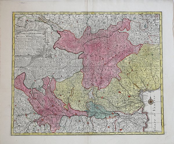
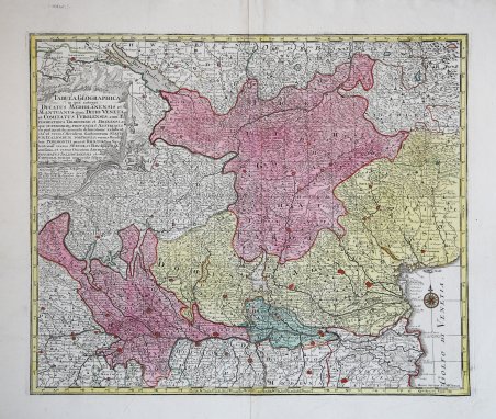
Carta geografica dell nord-est della penisola, comprendente il Tirolo ed estesa fino al Lago di Costanza. Incisione in rame, bella coloritura editoriale, in perfetto stato di conservazione.La mappa fornisce una visione topografica notevolmente dettagliata della regione a nord degli Appennini, comprese le fiorenti regioni commerciali e agricole tra Torino e Milano, fino alle regioni a ovest di Venezia, con inclusi molte strade e altri dettagli.La mappa include un elaborato cartiglio con il titolo che mostra l'attività militare nelle regioni montuose della mappa, con l'immagine di un cannone e un soldato, una rappresentazione allegorica delle battaglie combattute tra gli Asburgo a nord e le varie potenti famiglie italiane a sud, durante la prima metà del XVIII secolo. Matthäus Seutter (1678 - 1757) fu uno dei più importanti e prolifici editori tedeschi di mappe del XVIII secolo. Attivo, come incisore sotto la tutela dell'importante J. B. Homann. All'inizio del 1700 Seutter lasciò Homann per tornare ad Augusta, dove lavorò per l'importante editore d'arte Jeremia Wolff (1663 - 1724), per il quale incise mappe e altre stampe. Intorno al 1717 fondò la propria casa editrice cartografica indipendente ad Augusta. La maggior parte delle mappe di Seutter sono pesantemente basate, se non addirittura copie, di lavori precedenti fatti dalle calcografie Homann e De L'Isle. Ciononostante, dal 1731/32 Seutter era uno degli editori più prolifici del suo tempo e fu onorato dall'imperatore tedesco Carlo VI che gli diede il titolo di Geografo Imperiale, dopo il quale la maggior parte delle mappe successive includeva la denominazione ' Avec Privilege. ' Seutter continuò a pubblicare fino alla sua morte, all'apice della sua carriera, nel 1757. ' Acquaforte con coloritura editoriale, in ottimo stato di conservazione. Scarce regional map of Europe, extending from the Po River Valley to the Gulf of Venice and from the Boden Zee and Saltzburg, centered on Lago di Garda. The map provides a remarkably detailed topographical view of the region north of the Apennines, including the thriving commercial and agricultural regions from Turin and Milan to the low lying regions west of Venice, with many postal roads and other details shown. The map includes an elaborate title cartouche reflecting the military activity in the mountainous regions of the map, including an image of a cannon and soldier being hoisted up a steep cliff, an allegorical representation of the battles being waged between the Habsburgs to the north and the various powerful Italian families to the south during the first half of the 18th Century. Mattha?us Seutter (1678 - 1757) was one of the most important and prolific German map publishers of the 18th century. Seutter was born the son of a goldsmith but apprenticed as a brewer. Apparently uninspired by the beer business, Seutter abandoned his apprenticeship and moved to Nuremberg where he apprenticed as an engraver under the tutelage of the prominent J. B. Homann. Sometime in the early 1700s Seutter left Homann to return to Augsburg, where he worked for the prominent art publisher jeremiad Wolff (1663 - 1724), for whom he engraved maps and other prints. Most of Seutter's maps are heavily based upon, if not copies of, earlier work done by the Homann and De L'Isle firms. Nonetheless, by 1731/32 Seutter was one of the most prolific publishers of his time and was honored by the German Emperor Karl VI who gave him the title of Imperial Geographer, after which most subsequent maps included the Avec Privilege designation. ' Copperplate with fine original colouring, good condition. Cfr.


Descubre cómo utilizar
Descubre cómo utilizar

