Grabados
PLANCIUS Petrus
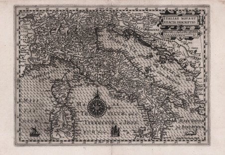
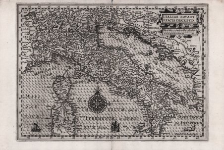
Italiae Nova et Exacta Descriptio
1605
1800,00 €
Antiquarius Libreria
(Roma, Italia) Habla con el libreroFormas de Pago
- PayPal
- Tarjeta de crédito
- Transferencia Bancaria
-
Descubre cómo utilizar
tu Carta del Docente -
Descubre cómo utilizar
tu Carta della cultura giovani e del merito
Detalles
Año de publicación
1605
Formato
330 X 240
Grabadores
PLANCIUS Petrus
Descripción
Carta geografica tratta dal Cosmographia Generalis di Paulus Merula. La carta, seppur di chiara ispirazione mercatoriana, rappresenta una riduzione di quella realizzata da Petrus Plancius nel 1592. Una bella rosa dei venti è posta al centro del mar Tirreno; la lastra è firmata in basso a destra Baptiste Doetecumus sculpsit. ' La raffinatezza dello stile incisorio di Baptiste van Doetecum è molto evidente in questa mappa. Baptiste era figlio di Joannes, che insieme al fratello Lucas, proveniva da una famiglia di incisori originaria di Deventer, attiva ad Anversa, Haarlem e Amsterdam nella seconda metà del XVI secolo. Oltre alle mappe dello Spieghel, i Doetecum sono autori delle più belle carte pubblicate da Hieronymus Cock, Gerard de Jode e Abraham Ortelius. Incisione in rame, in ottimo stato di conservazione. Molto rara. ' Bibliografia R. Borri, Italia nelle antiche carte dal Medioevo all'Unità nazionale (2011), scheda 86; The New Hollstein (Doetecum) n. 999; Gunter Schilder, Monumenta Cartographica Neerlandica, I, p. 30, 20. A rare map taken from Cosmographia Generalis by Paulus Merula. The map, though clearly inspired by Mercator, represents a reduction of one made by Petrus Plancius in 1592. A nice compass is placed at the center of the Tyrrhenian Sea. The plate is signed at lower right Baptiste Doetecumus sculpsit. The qualityof Baptiste van Doetecum's engraving style is very evident in this map. Baptiste was the son of Joannes, who together with his brother Lucas, came from a family of engravers originally from Deventer, active in Antwerp, Haarlem and Amsterdam in the second half of the sixteenth century. In addition to the Spieghel maps, the Doetecums are authors of the most beautiful maps published by Hieronymus Cock, Gerard de Jode and Abraham Ortelius. Copper engraving, in excellent condition. ' Bibliografia R. Borri, Italia nelle antiche carte dal Medioevo all'Unità nazionale (2011), scheda 86; The New Hollstein (Doetecum) n. 999; Gunter Schilder, Monumenta Cartographica Neerlandica, I, p. 30, 20. Cfr.