Grabados
ARROWSMITH Aaron
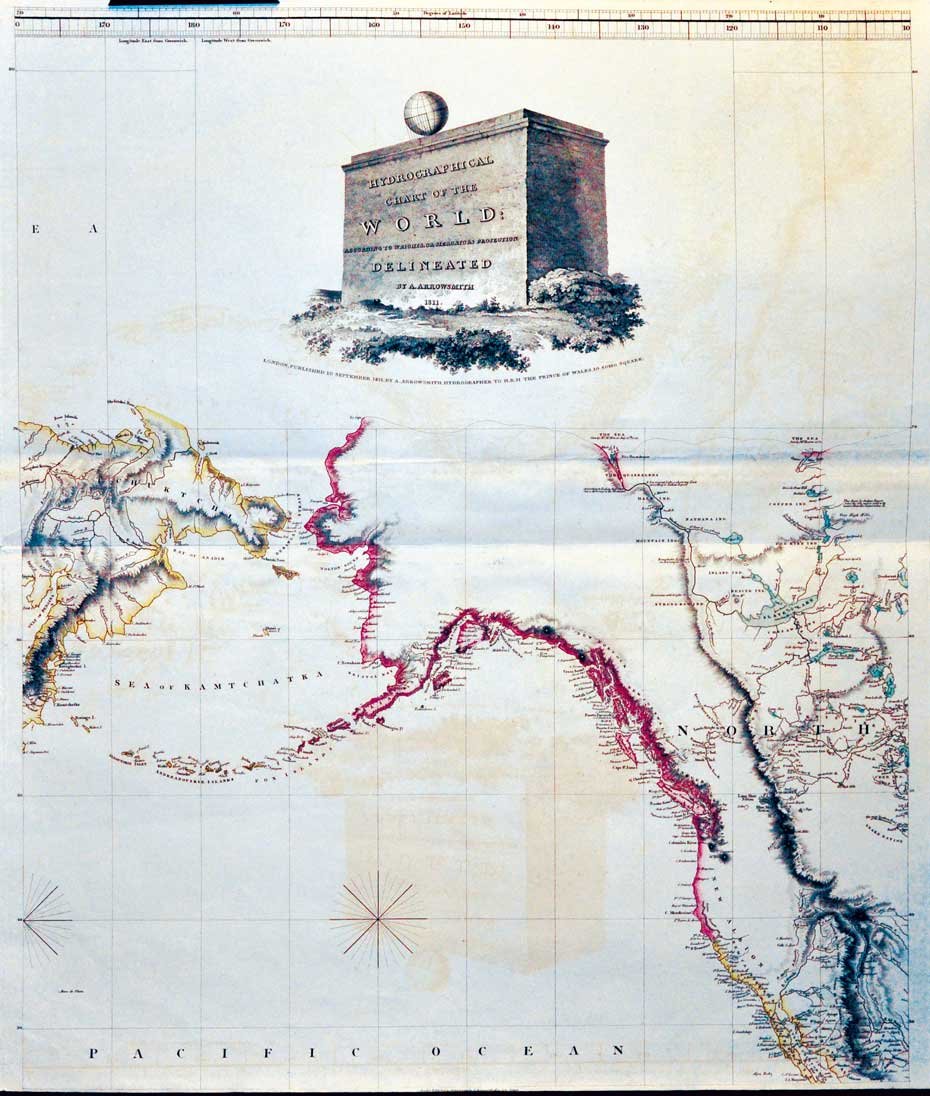
HYDROGRAPHICAL CHART OF THE WORLD. - According to Wrights or Mercators projection. Delineated by A. Arrowsmith.
1811
540,00 €
Malavasi Libreria Antiquaria
(Milano, Italia) Habla con el libreroFormas de Pago
- PayPal
- Tarjeta de crédito
- Transferencia Bancaria
-

-
 Descubre cómo utilizar
tu Carta del Docente -
 Descubre cómo utilizar
tu Carta della cultura giovani e del merito
Detalles
Año de publicación
1811
Lugar de impresión
London,
Editor
A. Arrowsmith (10 Soho Sq,),
Grabadores
ARROWSMITH Aaron
Materia
ARTE GRAFICA, NORD AMERICA COSTA OCCIDENTALE CARTA NAUTICA 1800
Descripción
Bella carta nautica, incisa in rame e a colori, di cm. 77,5 x 73. E' dedicata alla "Costa Occidentale del Nord America".Cfr. Tooley's Dictionary of Mapmakers, p. 24: Aaron Arrowsmith (1750-1833), English cartographer, engraver and publisher. In 1790 he set up his own establishment in London and he became hydrographer to Prince of Wales ca. 1810 and to His Majesty 1820. In all he issued 200 maps, mostly large scale, and was easily the foremost cartographer of his time. Esemplare ben conservato.