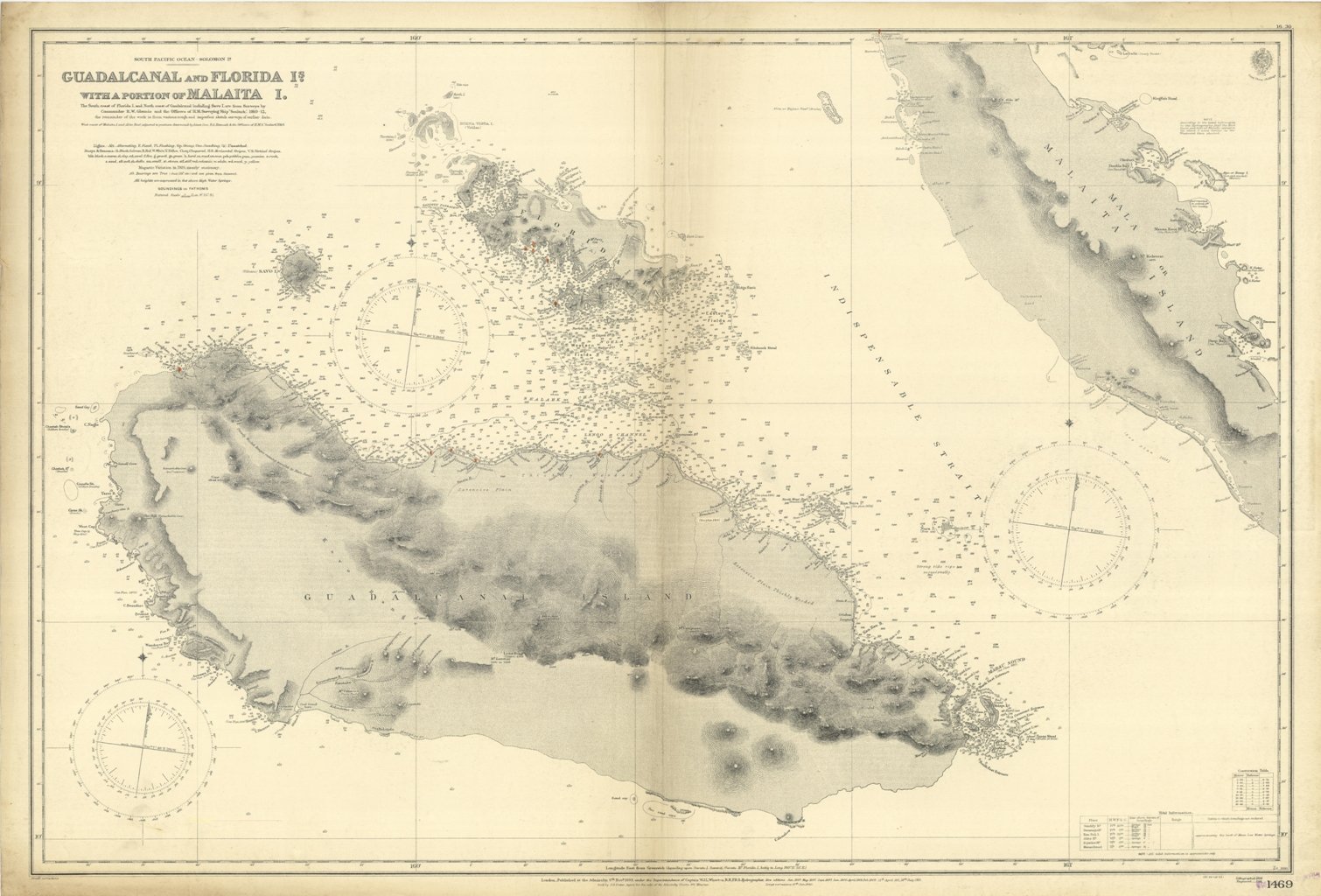
Guadalcanal and Florida I.s with a portion of Malaita I.
Guadalcanal and Florida I.s with a portion of Malaita I. | Grabados | Admiralty Charts, Admiralty Charts
Guadalcanal and Florida I.s with a portion of Malaita I.
Guadalcanal and Florida I.s with a portion of Malaita I. | Grabados | Admiralty Charts, Admiralty Charts
Formas de Pago
- PayPal
- Tarjeta de crédito
- Transferencia Bancaria
- Pubblica amministrazione
- Carta del Docente
Detalles
- Formato
- mm 658x983
- Edición
- '900
- Grabadores
- Admiralty Charts
- Materia
- Guadalcanal - Solomon Islands - Pacific Ocean
- Diseñadores
- Admiralty Charts
- Idiomas
- Italiano
Descripción
Guadalcanal and Florida I.s with a portion of Malaita I. The South coast of Florida I. and North coast of Guadalcanal including Savo I are from Surveys by Commander R.W. Glennie and the Officers of H.M. Surveying Ship "Sealark", 1910-12, the remainder of the work is from various rough and imperfect sketch surveys of earlier date. West coast of Malaita I and Alite Reef, adjusted to positions determined by Lieut. Com. R.L. Hancock & the Officers of H.M.S. "Sealark", 1914. London Published at the Admiralty, 6th Nov. 1893, under the Superintendence of Captain W.J.L. Wharton, Hydrographer. Large corrections 10 th Jan. 1930. Interesting map of Guadacanal in which the capital Honiara is missing because it will be constructed only afet the second world war. Folded editorially. Autore: Admiralty Charts. Luogo: Guadalcanal - Solomon Islands - Pacific Ocean. Anno: '900. Tecnica: incisione. Dimensioni: 658x983 mm
Anno di pubblicazione: '900
