Questo sito usa cookie di analytics per raccogliere dati in forma aggregata e cookie di terze parti per migliorare l'esperienza utente.
Leggi l'Informativa Cookie Policy completa.

Grabados

DUDLEY ROBERT - LUCINI ANTON FRANCESCO.

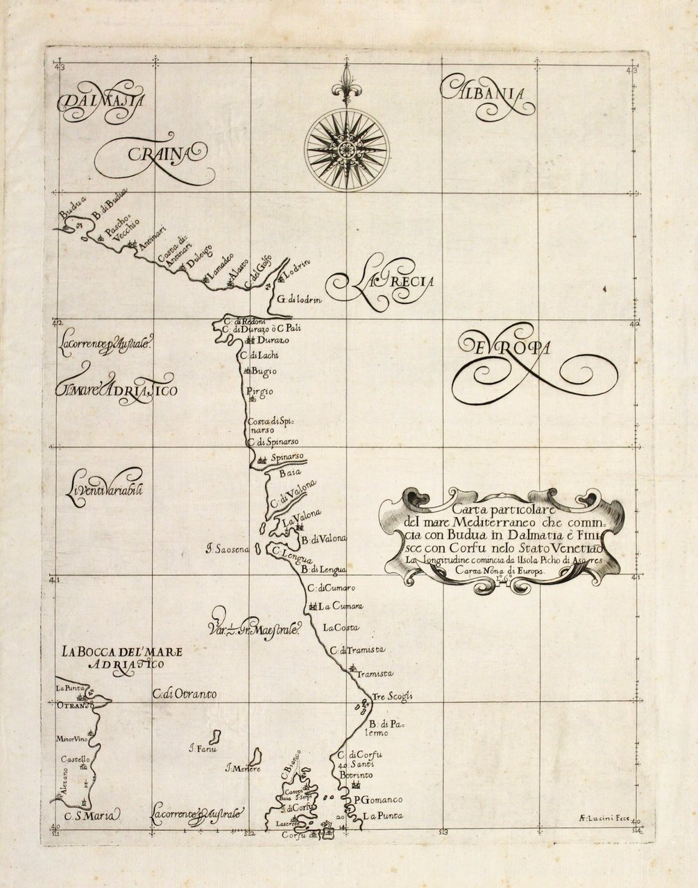
Carta particolare del mare Mediterraneo che commincia con Budua in Dalmatia è finisce con Corfu nelo Stato Venetiano.

1645

1500,00 €

Perini Libreria Antiquaria

(Verona, Italia)

Habla con el librero

Formas de Pago

Detalles

Año de publicación
1645
Lugar de impresión
Firenze
Grabadores
DUDLEY ROBERT - LUCINI ANTON FRANCESCO.
Materia
Albania Otranto Corfù

Descripción

Incisione in rame, incisa da Lucini, mm 425x325. La carta raffigura la costa dalmata da Budua a Corfù e l'estremità meridionale della Puglia (Otranto e Capo S. Maria); tratta da "Dell'Arcano del Mare" di Robert Dudley (1574-1649), che rappresenta il primo atlante marittimo del mondo intero stampato da un inglese e ad usare la proiezione di Mercatore e la declinazione magnetica. Le mappe sono tutte originali, caratterizzate dalla particolare decorazione barocca di Lucini. Dudley lasciò l'Inghilterra nel 1605 e si trasferì al servizio di Cosimo II, Gran Duca di Toscana come ingegnere e comandante navale. Nel 1646, dopo 12 anni di fatica, pubblicò l'atlante. Lucini, l'incisore nacque a Firenze, fu allievo di Callot e amico di Della Bella. A lui si deve la finezza incisoria e la bellezza del testo inciso "alla Cancelleresca". Robert Dudley's "Arcano del mare" is "one of the greatest atlases of the world and one of the most complex ever produced: it is the first sea-atlas of the whole world; the first with all the charts constructed using Mercator's new projection, as corrected by Edward Wright; the first to give magnetic declination; the first to give prevailing winds and currents. the first to expound the advantages of "Great Circle Sailing"; and the first sea-atlas to be compiled by an Englishman." (Lord Wardington). Ottimo esemplare a pieni margini. € 1.500<BR>Copper engraving, mm 425x325, from "Dell'Arcano del Mare" by Robert Dudley (1574-1649), the first world marittime atlas printed by an englishman and the first using Mercator's projection. The chart depicts the southern part of the Adriatic Sea included part of Corfu and part of Italy (Otranto and Capo S. Maria)<BR> The charts are all original and engraved by Lucini. Robert Dudley's "Arcano del mare" is "one of the greatest atlases of the world and one of the most complex ever produced: it is the first sea-atlas of the whole world; the first with all the charts constructed using Mercator's new projection, as corrected by Edward Wright; the first to give magnetic declination; the first to give prevailing winds and currents. the first to expound the advantages of "Great Circle Sailing"; and the first sea-atlas to be compiled by an Englishman." (Lord Wardington). Very good condition with full margins. <BR>