Anchorages in the Galapagos Islands
Anchorages in the Galapagos Islands | Grabados | Admiralty Charts, Admiralty Charts
Anchorages in the Galapagos Islands
Anchorages in the Galapagos Islands | Grabados | Admiralty Charts, Admiralty Charts
Formas de Pago
- PayPal
- Tarjeta de crédito
- Transferencia Bancaria
- Pubblica amministrazione
- Carta del Docente
Detalles
- Formato
- mm 639x1105
- Edición
- '900
- Grabadores
- Admiralty Charts
- Materia
- Galapagos Islands - Pacific Ocean
- Diseñadores
- Admiralty Charts
- Idiomas
- Italiano
Descripción
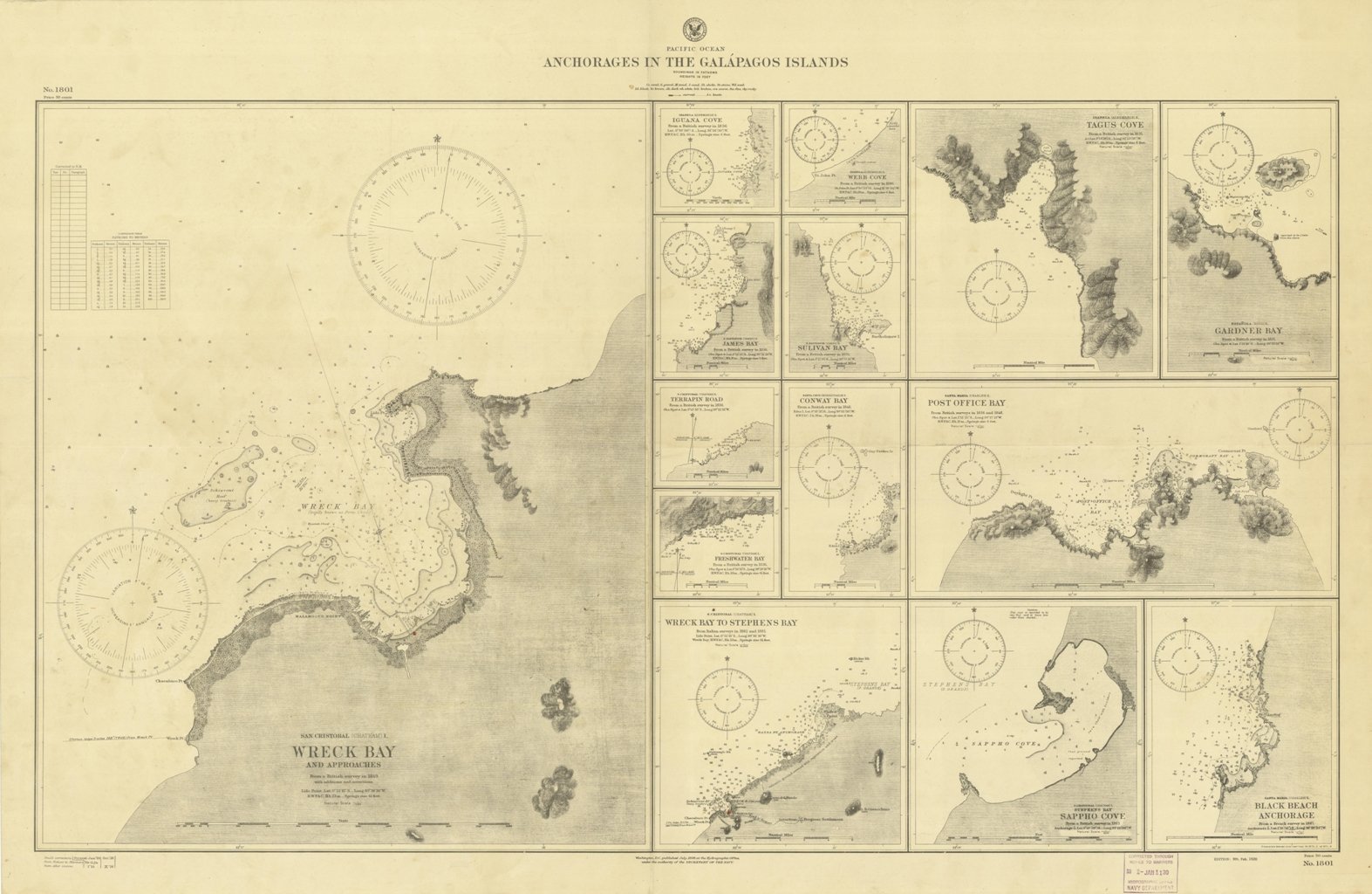
Anchorages in the Galapagos Islands.In the left part of the chart insert of Wreck Bay and approaches From a British survey in 1849 with additions and corrections. In the middle of the chart insert of Iguana Cove From a British survey in 1836, Webb Cove From a British survey in 1886, James Bay From a British survey in 1836, Sulivan Bay From a British survey in 1836, Terrapin Road From a British survey in 1836, Freshwater Bay From a British survey in 1836, Conway Bay From a British survey in 1846, Wreck Bay to Stephens Bay From Italian surveys in 1882 and 1885. In the right part of the chart insert of Tagus Cove From a British survey in 1835, Gardner Bay From a British survey in 1835, Post Office Bay From British surveys in 1836 and 1846, Sappho Cove From a British survey in 1883, Black Beach Anchorage From a French survey in 1887. Washington D.C., published July, 1899, at the Hydrographic Office, under the authority of the Secretary of the Navy. Small corrections: Printed: Oct. 1926. Folded editorially. Autore: Admiralty Charts. Luogo: Galapagos Islands - Pacific Ocean. Anno: '900. Tecnica: incisione. Dimensioni: 639x1105 mm
Anno di pubblicazione: '900
