Libros antiguos y modernos
SUSA (VEDUTA)
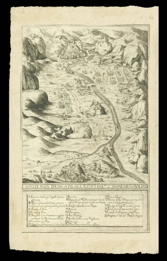
Sito di Susa dedicato all'Ill.mo et Ecc.mo S. Domenico Molino
ca.1630, , ca.1630
3300,00 €
Pregliasco Libreria Antiquaria
(Torino, Italia)
Los gastos de envío correctos se calculan una vez añadida la dirección de envío durante la creación del pedido. El vendedor puede elegir uno o varios métodos de envío: standard, express, economy o in store pick-up.
Condiciones de envío de la Librería:
Para los productos con un precio superior a 300 euros, es posible solicitar un plan de pago a plazos al Maremagnum. El pago puede efectuarse con Carta del Docente, Carta della cultura giovani e del merito, Administración Pública.
Los plazos de entrega se estiman en función de los plazos de envío de la librería y del transportista. En caso de retención aduanera, pueden producirse retrasos en la entrega. Los posibles gastos de aduana corren a cargo del destinatario.
Pulsa para saber másFormas de Pago
- PayPal
- Tarjeta de crédito
- Transferencia Bancaria
-
-
Descubre cómo utilizar
tu Carta del Docente -
Descubre cómo utilizar
tu Carta della cultura giovani e del merito
Detalles
Descripción
Engraved Bird's-eye view of the Susa Valley, an important strategic route between southern France to Italy. The view is taken a vantage point above the town of Avigliana, looking towards its fort, with the city of Susa, in the distance. The map was prepared at the time of the War of the Mantuan Succession (1628-1631), as France and the Habsburgs vied to install their favoured candidate as Duke of Mantua and thus gain control of northern Italy. With the end of the Huguenot revolt centred on La Rochelle, Louis XIII and his first minister Cardinal Richelieu despatched an army to Italy to assist their allies. This army entered Italy in early March 1629 and seized Susa on 6th March to secure their lines of communication. This plan shows the approximate position of the rival troops on either side of the river; a key below the plan lists twenty-three important features. Susa later gave its name to the treaty signed between the French and Savoy, signed in April 1629 which temporarily ended the war in the region. Unrecorded in Peyrot, The Susa and Sangone; Bibliothèque nationale de France, département de Cartes et plans, GE D-17018.

