Details
Place of printing
Amsterdam
Engravers
JANSSONIUS JOANNES
State of preservation
New
Description
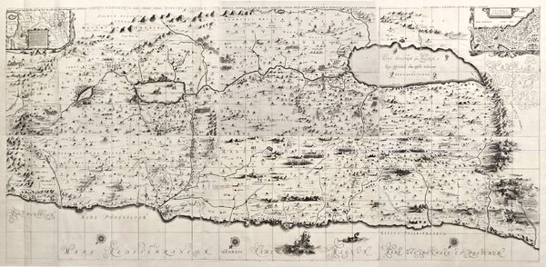
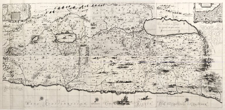
Incisione in rame, 6 fogli da unire che formano una carta di mm 860x1800. Una delle più famose carte seicentesche della Terra santa, priva di un titolo generale, anche se ogni foglio ha una indicazione del nome delle tribù. Tratta da “Accurata Orbis antiqui Delineatio” l’atlante storico, curato da Hornius ed inserito da Janssonius come volume VI del suo “Atlas Novus”. La carta raffigura i territori delle 12 tribù d’Israele ed è come al solito orientata col nord a sinistra. Deriva dalla carta di Adricom del 1590 ma viene arricchita da numerosi elementi decorativi e scene bibliche come il profeta Giona che sta per essere mangiato da una balena, le città di Sodoma e Gomorra e molte altre fra cui scene della vita di Gesù; nei due angoli superiori le piccole carte raffigurano il viaggio di Abramo e il percorso degli Ebrei fuggiti dall'Egitto. Janssonius, genero di Jodocus Hondius e cognato di Henricus, collaborò alla pubblicazione di atlanti, dopo l’acquisizione delle lastre di Mercatore da parte di Jodocus e dal 1638 fu in effetti colui che guidò l’impresa editoriale, mentre Henricus Hondius lentamente abbandonava l’attività (dal 1646 il suo nome non apparirà più su alcun frontespizio); risultò così divenire il grande avversario della famiglia Blaeu nel secolo d’oro della cartografia olandese. Perfetto esemplare marginosissimo. Copper engraving, mm 370x500. From “Accurata Orbis antiqui Delineatio”, Janssonius’ historical atlas with text by Hornius, published as volume VI of his Atlas Novus. Johannes Janssonius (1588 - 1664) was born in Arnhem, Holland. He was the son of a printer and bookseller and in 1612 married the daughter of Hondius. In 1616 Jansson produced his first maps influenced by Blaeu. In the mid 1630s Jansson partnered with his brother-in-law, Henricus Hondius, to produce his important work, the eleven volume Atlas Major. About this time, Jansson's name also begins to appear on Hondius reissues of notable Mercator/Hondius atlases. Georg Horn (1620 - 1670) german historian and professor, composed a number of historical essays but is best known for composing the text to accompany Johannes Jansson's historical atlas. Koeman, 8150:1D/1 à 6 ; Laor, 343-349. Copper engraving, 6 large unjoined sheets, mm 860x1800 if joined. Famous map of Holy Land after Adricom's map of 1590 showing the 12 Tribes of Israel land. Enriched by many biblical decorative scenes. Very good example with wide margins. From "Accurata Orbis antiqui Delineatio", Janssonius' historical atlas with text by Hornius, published as volume VI of his Atlas Novus. Johannes Janssonius (1588 - 1664) was born in Arnhem, Holland. He was the son of a printer and bookseller and in 1612 married the daughter of Hondius. In 1616 Jansson produced his first maps influenced by Blaeu. In the mid 1630s Jansson partnered with his brother-in-law, Henricus Hondius, to produce his important work, the eleven volume Atlas Major. About this time, Jansson's name also begins to appear on Hondius reissues of notable Mercator/Hondius atlases. <BR>Georg Horn (1620 - 1670) german historian and professor, composed a number of historical essays but is best known for composing the text to accompany Johannes Jansson's historical atlas. <BR>Koeman, 8150:1D/1 à 6 ; Laor, 343-349. <BR>


Find out how to use
Find out how to use

