Papua or New Guinea
Papua or New Guinea | Prints | Admiralty Charts
Prints
Admiralty Charts
Papua or New Guinea
Papua or New Guinea | Prints | Admiralty Charts
Prints
Admiralty Charts
80.00 €
(Gavirate,
Italy)
Payment methods
- PayPal
- Credit card
- Bank transfer
- Pubblica amministrazione
- Carta del Docente
Details
- Size
- mm 626x953
- Edition
- '900
- Keyword
- Nuova Guinea
- Designers
- Admiralty Charts
Description
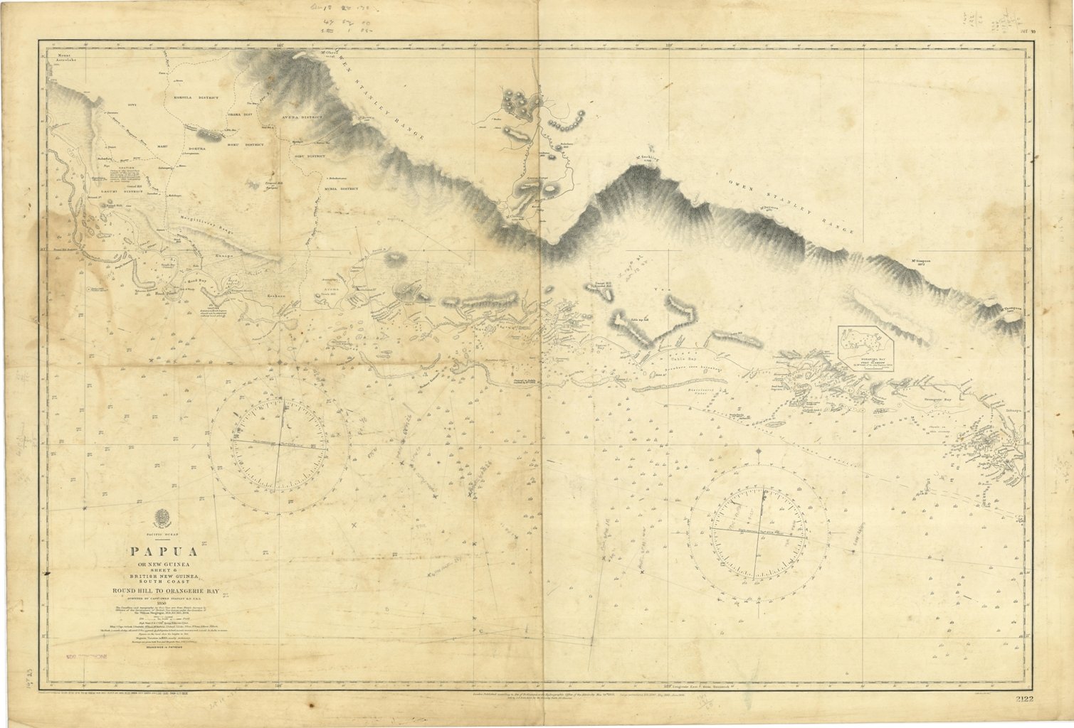
Papua or New Guinea - sheet 6 - British New Guinea South Coast Round Hill to Orangerie Bay surveyed by Capt. Owen Stanley 1850. The Coastline and topography in fine line are from Sketch Surveys by Officers of the Government of British New Guinea under the direction of Sir WilliamMacgregor, 1891. In the right side of the chart a small insert of Nobanoka Bay or Port Glasgow by Mr. Goldic of the ship Explorer 1878. London Published according to Act of Parliament at the Hydrographic Office of the Admiralty May 24th 1852. Small corrections: 1928. Editorially folded. Autore: Admiralty Charts. Luogo: Nuova Guinea. Anno: '900. Dimensioni: 626x953 mm
Anno di pubblicazione: '900
