Details
Place of printing
Venezia
Engravers
CORONELLI Vincenzo
Description
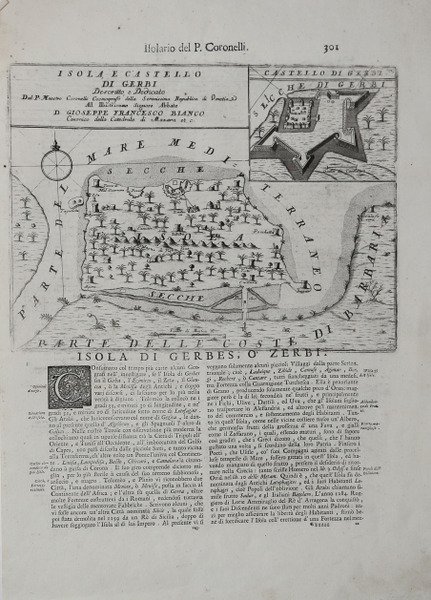
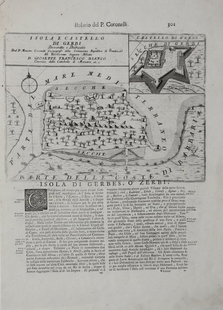
Carta raffigurante Djerba, tratta dall’Isolario dell’Atlante Veneto del P. Coronelli, In Venetia MDCXCVI. Coronelli visse un periodo di straordinaria fecondità editoriale a partire dal 1689, quando ebbe la cattedra di geografia presso l'Università alle Procuratie, con la pubblicazione, nel 1690, del primo volume dell'Atlante Veneto. In effetti sotto il nome di ' Atlante Veneto ' va tutta la raccolta di tredici opere composte nell'arco del decennio successivo, dall'Isolario ' allo ' Specchio del mare. L'Isolario ' mira, con una barocca e minuziosa ricerca del dettaglio, alla celebrazione dei possedimenti della Serenissima. Monumentale raccolta di carte e vedute di isole, rappresenta l'ultimo degli “isolari” concepiti, che, tra la fine del XVII e l'inizio del XVIII secolo, vennero progressivamente soppiantati dagli atlanti di moderna concezione, opere a stampa caratterizzate da crescente precisione scientifica e da sempre minore pregio artistico. Sulla scia delle nuove conquiste coloniali le rappresentazioni cartografiche vennero ad assumere un carattere sempre più tecnico, fino ad allora piuttosto arbitrario. Esemplare in buone condizioni. Decorative map of Djerba, taken from ' Isolario dell’Atlante Veneto del P. Coronelli, In Venetia MDCXCVI. Coronelli lived a period of extraordinary editorial fecundity starting from 1689, when he had the chair of geography at the University at the Procuratie, with the publication, in 1690, of the first volume of the ' Atlante Veneto. Under the name of ' Atlante Veneto ' goes the entire collection of thirteen works composed over the next decade, from the ' Isolario ' to the ' Specchio del mare. The ' Isolario ' aims, with a baroque and meticulous search for detail, to celebrate the possessions of the Serenissima. Monumental collection of maps and views of islands, represents the last of the "isolarios" conceived, which, between the end of the seventeenth and the beginning of the eighteenth century, were gradually supplanted by modern atlases, printed works characterized by increasing scientific precision and less and less artistic value. In the wake of the new colonial conquests, cartographic representations came to assume an increasingly technical character, until then rather arbitrary. Coronelli was possibly the best Italian mapmaker of his time. He made globes, including one 5 meters in diameter for Louis XIV. From Coronelli's rare Atlante Veneto, one of the most decorative and ornate of all 17th Century Atlases. The map exhibits the fine engraving style of this coveted Venetian Atlas.Copperplate, good condition. Cfr.


Find out how to use
Find out how to use

