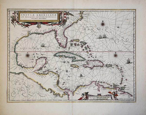
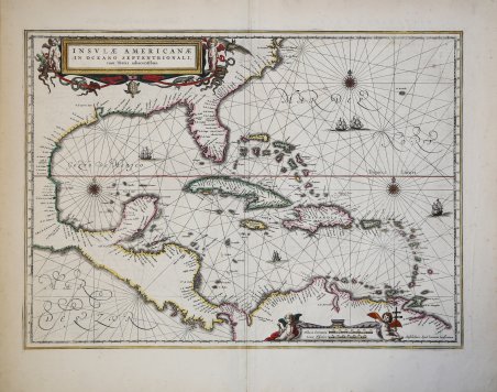
Raffinata incisione raffigurante il Golfo del Messico e le isole delle Indie Occidentali insieme alla costa americana settentrionale e meridionale. Il dato cartografico si basa sulla rara carta del Gerritsz del 1631. L’area contemplata è esattamente quella illustrata da Gerritsz, ad eccezione dell’inclusione della costa occidentale del Centro America. La nomenclatura nel Nord America è praticamente identica, a parte l’aggiunta della Viriginia in questa carta. La mappa di Gerritsz è il frutto delle osservazioni dirette, realizzate dal cartografo durante il suo viaggio in Sud America e Indie Occidentali nel 1628. Il Golfo del Messico e i Carabi sono disegnati con linee lossodromiche, splendide rose dei venti e vascelli in navigazione. Joannes Janssonius, figlio dell'editore di Arnhem Jan Janssen, sposò Elisabeth Hondius, figlia di Jodocus Hondius, ad Amsterdam nel 1612. Dopo il suo matrimonio, si stabilì in questa città come libraio ed editore di materiale cartografico. Nel 1618 si stabilì ad Amsterdam accanto alla libreria di Willem Jansz. Blaeu, entrando in una seria competizione. Le sue attività non riguardavano solo la pubblicazione di atlanti e libri, ma anche di mappe singole e un vasto commercio di libri con filiali a Francoforte, Danzica, Stoccolma, Copenaghen, Berlino, Koningsbergen, Ginevra e Lione. Nel 1631 iniziò a pubblicare atlanti insieme a Henricus Hondius. Nei primi anni 1640 Henricus Hondius lasciò l'attività di pubblicazione di atlanti completamente a Janssonius. La concorrenza con Joan Blaeu, figlio e successore di Willem, nella produzione di atlanti spinse Janssonius ad ampliare il suo Atlas Novus finalmente in un'opera di sei volumi, in cui furono inseriti un atlante marino e un atlante del Vecchio Mondo. Dopo la morte di Joannes Janssonius, il negozio e la casa editrice furono continuati dagli eredi sotto la direzione di Johannes van Waesbergen (c. 1616-1681), genero di Joannes Janssonius. Le matrici degli atlanti di Janssonius furono in seguito vendute a Schenk e Valck. Cartigli e scala sono arricchite da putti e da un’insolita selezione di fauna locale, tra cui serpenti, lucertole, una tartaruga marina e un pipistrello. Sia le linee costiere sia le isole riportano numerosi toponimi. Mappa altamente decorativa. Finely engraved map, showing the Gulf of Mexico and the West Indian Islands, and the adjacent North and South American coastlines.The cartography is based on the rare Gerritz chart of 1631. The area covered is exactly the same as Gerritsz map, except for the addition of the west coast of Central America. The nomenclature in North America is virtually identical, other than the addition of Viriginia on this map. It reflects the first hand knowledge of Gerritsz during his voyage to South America and the West Indies undertaken in 1628. The Gulf of Mexico and the Caribbean are charted out with rhumb lines, attractive compass roses and sailing ships. The cartouche and scales are decorated with putti and an unusual selection of fauna, including snakes, lizards, a sea tortoise and a bat. Both the coastline and the islands show many place-names. Joannes Janssonius (Arnhem, 1588-1664), son of the Arnhem publisher Jan Janssen, married Elisabeth Hondius, daughter of Jodocus Hondius, in Amsterdam in 1612. After his marriage, he settled down in this town as a bookseller and publisher of cartographic material. In 1618 he established himself in Amsterdam next door to Blaeu’s book shop. He entered into serious competition with Willem Jansz. Blaeu. His activities not only concerned the publication of atlases and books, but also of single maps and an extensive book trade with branches in Frankfurt, Danzig, Stockholm, Copenhagen, Berlin, Koningsbergen, Geneva, and Lyon. In 1631 he began publishing atlases together with Henricus Hondius. In the early 1640s Henricus Hondius left the atlas publishing business completely to Janssonius. Competition with Joan Blaeu, Willem’s son and successor, in atlas production prompted Janssonius to enlarge his Atlas Novus finally into a work of six volumes, into which a sea atlas and an atlas of the Old World were inserted. After the death of Joannes Janssonius, the shop and publishing firm were continued by the heirs under the direction of Johannes van Waesbergen (c. 1616-1681), son-in-law of Joannes Janssonius. The copperplates from Janssonius’s atlases were afterwards sold to Schenk and Valck. A very decorative map. Cfr. Burden, Maps of America 248


Find out how to use
Find out how to use

