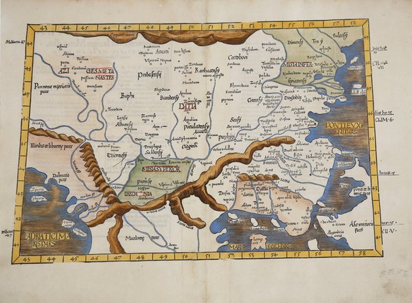
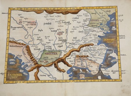
Mappa trapezoidale che si concentra su una porzione dell'Europa orientale e sul bordo occidentale dell'Anatolia (Asia Minore). Comprende parti della Grecia, della Dacia, della Macedonia e della regione dell'odierna Ucraina che si trova sul Mar Nero. Il confine settentrionale della mappa è formato dai Carpazi. Sono raffigurate porzioni di tre mari, inclusa parte del Mar Nero, dell'Egeo e dell'Adriatico. La mappa nomina luoghi storici come l'antico regno di Bitinia, la Troade nell'odierna Turchia e Ilio dell'epica Iliade di Omero. L'odierna Istanbul è chiamata Bizantina, forse un cenno al leggendario Byzas, che nella mitologia greca si dice sia stato il fondatore della zona della città che sarebbe diventata Costantinopoli, la capitale orientale dell'Impero Romano. Le catene montuose e molti sistemi fluviali sono mostrati in dettaglio. Bell'esemplare dell'edizione del 1541 della mappa tolemaica di Lorenz Fries dei Balcani. La mappa è basata sulla mappa di Waldseemuller, pubblicata per la prima volta nella Geographia di Strasburgo del 1513. La prima edizione della "Geographia" di Tolomeo curata da Fries fu pubblicata a Strasburgo nel 1522, con le carte che furono copiate e nuovamente incise da quelle di Martin Waldseemüller dell'edizione di Tolomeo del 1520 e testo a cura di Pirckheimer. Nel 1525 viene stampata una seconda edizione a Strasburgo. Alla scomparsa del Fries e del Gruninger, le matrici furono acquistate dai fratelli Melchior e Gaspar Treschel che ne stampano una terza edizione a Lione nel 1535. Per il testo i due editori si servirono della supervisione di Michael Servetus, che curò la revisione del testo del Pirckheimer. Infine, nel 1541, Gaspare Treechsel pubblica a Vienne, nel Delfinato, questa quarta edizione, sempre con testo di Servetus. In questa edizione, rispetto alla prima di Strasburgo del 1522, il testo subì numerose modifiche, correzioni e aggiunte, ma i legni non furono modificati. Xilografia, finemente colorata a mano, in ottimo stato di conservazione. Trapezoidal map focuses on a portion of eastern Europe and the western edge of Anatolia (Asia Minor). It includes parts of Greece, Dacia, Macedonia, and the region of modern day Ukraine which is on the Black Sea. The northern boundary of the map is formed by the Carpathian Mountains. Portions of three seas are depicted, including part of the Black, the Aegean, and the Adriatic Seas. The map names historical places such as the ancient kingdom of Bithynia, the Troas in modern day Turkey and Ilium of Homer’s epic Iliad. Modern day Istanbul is named Byzantine, perhaps a nod to legendary Byzas, who in Greek mythology is said to have been the area’s founder of the city which would become Constantinople, the eastern capitol of the Roman Empire. ' Familiar names dot the region on the European side of the Bosphorus as well. Mountain chains and many river systems are shown in detail. Nice example of the 1541 edition of Lorenz Fries Ptolemaic map of ' the Balkans. The map is based upon Waldseemuller's Ptolemaic map of the British Isles, first published in 1513. The first edition of Ptolemy's ' Geographia ' edited by Fries was published in Strasbourg in 1522, with maps that were copied and re-engraved from those of Martin Waldseemüller of the 1520 edition of Ptolemy and text edited by Pirckheimer. In 1525 a second edition was printed in Strasbourg. At the death of Fries and Gruninger, the plates were purchased by the brothers Melchior and Gaspar Treschel, who printed a third edition in Lyon in 1535. For the text, the two editors used the supervision of Michael Servetus, who edited Pirckheimer's text. Finally, in 1541, Gaspare Treechsel published in Vienne, in the Dauphiné, this fourth edition, again with Servetus' text. In this edition, compared to the first edition of Strasbourg in 1522, the text underwent numerous changes, corrections and additions, but the wood-blocks were not changed. ' Woodcut, finely colored by hand, in excellent condition. Cfr.


Find out how to use
Find out how to use

