Details
Description
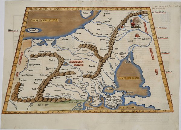
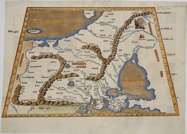
Carta tolemaica dell'antica regione della Sarmazia corrispondente all'attuale territorio di Ucraina e Russia. Questa regione era conosciuta in epoca romana come ' Sarmatia Europae ' e rappresentava il limite della conoscenza accurata della geografia del mondo romano verso nord-est. La mappa è particolarmente dettagliata nelle aree lungo la costa del Mar Nero, comprese l'Ucraina e la Crimea. Tuttavia, il Mare d'Azov (allora noto come Lago Maeotiano) è fortemente distorto e tutti i punti a est sembrano essere dovuti più a voci che a contatti reali. La mappa è basata sulla mappa di Waldseemuller, pubblicata per la prima volta nella ' Geographia ' di Strasburgo del 1513. La prima edizione della "Geographia" di Tolomeo curata da Fries fu pubblicata a Strasburgo nel 1522, con le carte che furono copiate e nuovamente incise da quelle di Martin Waldseemüller dell'edizione di Tolomeo del 1520 e testo a cura di Pirckheimer. Nel 1525 viene stampata una seconda edizione a Strasburgo. Alla scomparsa del Fries e del Gruninger, le matrici furono acquistate dai fratelli Melchior e Gaspar Treschel che ne stampano una terza edizione a Lione nel 1535. Per il testo i due editori si servirono della supervisione di Michael Servetus, che curò la revisione del testo del Pirckheimer. Infine, nel 1541, Gaspare Treechsel pubblica a Vienne, nel Delfinato, questa quarta edizione, sempre con testo di Servetus. In questa edizione, rispetto alla prima di Strasburgo del 1522, il testo subì numerose modifiche, correzioni e aggiunte, ma i legni non furono modificati. Esemplare tratto dall’edizione del 1541, del "Claudii Ptolemaei Alexandrini Geographicae Enarrationis". Xilografia, finemente colorata a mano, in ottimo stato di conservazione. Ptolemaic map of ancient Sarmatia the region between the Baltic, Adriatic and Black Seas. ' This region was known in the Roman period as Sarmatia Europae, and it represented the limit of the Roman world’s accurate knowledge of geography to the northeast. The map is particularly detailed in those areas along the Black Sea coast, including the Ukraine and the Crimea. However, the Sea of Azov (then known as the Maeotian Lake) is greatly distorted, and all points east appear to owe more to rumor than to actual contact. Nice example of the 1541 edition of Lorenz Fries ' map, based upon Waldseemuller's map, first published in 1513. The first edition of Ptolemy's ' Geographia ' edited by Fries was published in Strasbourg in 1522, with maps that were copied and re-engraved from those of Martin Waldseemüller of the 1520 edition of Ptolemy and text edited by Pirckheimer. In 1525 a second edition was printed in Strasbourg. At the death of Fries and Gruninger, the plates were purchased by the brothers Melchior and Gaspar Treschel, who printed a third edition in Lyon in 1535. For the text, the two editors used the supervision of Michael Servetus, who edited Pirckheimer's text. Finally, in 1541, Gaspare Treechsel published in Vienne, in the Dauphiné, this fourth edition, again with Servetus' text. In this edition, compared to the first edition of Strasbourg in 1522, the text underwent numerous changes, corrections and additions, but the wood-blocks were not changed. ' Woodcut, finely colored by hand, in excellent condition. Cfr.


Find out how to use
Find out how to use

