Questo sito usa cookie di analytics per raccogliere dati in forma aggregata e cookie di terze parti per migliorare l'esperienza utente.
Leggi l'Informativa Cookie Policy completa.

Prints

Admiralty Charts

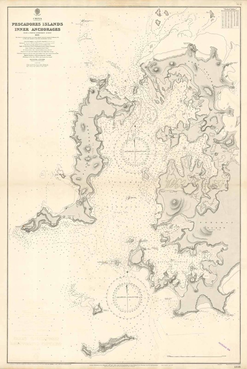
China Pescadores Islands Inner Anchorages

250.00 €

Trippini Sergio Libreria

(Gavirate, Italy)

Ask for more info

Payment methods

Details

Size
mm 992x648
Edition
'900
Keyword
Penghu Islands - Taiwan
Designers
Admiralty Charts

Description

The Pescadores Islands, today Penghu Islands, Inner Anchorages from a French Government Survey 1886. "The Outer or Seaward portion are from a Sketch Survey by Captain R. Collinson in 1844, and should be used with considerable caution.". London published at the Admiralty 14 October 1895. Small corrections: 1928"Hoko (Ponghau) Island and Gyoo (Fisher) Island, the two largest islands, lie near the center of the group, and between them is the extensive and excellent harbor of Hoko. Most of the islands have green tops, being terraced for cultivation everywhere practicable. Potatoes, maize, millet, and groundnuts are produced in considerable quantities, as well as a few other vegetables, but the soil is not good, being chiefly light and sand mixed with coraldébris. Owing to the violence of the northeast monsoon , there are no trees, but the islands are well supplied with fruits and vegetables from Taiwan. " (*)"Hoko Island, the largest of the Pescadores, is 74 miles in extent, northeast and southwest ; northward of it is an islet and northward again is Hakusa Island, which is about 3 miles long north and south. The channels separating these islands are narrow, with only 2 feetin them at low water, and further blocked by stone weirs. The west ern side of these islands is fronted by coral reefs." (*)"Hoko ( Ponghau ) Harbor, between Hoko and Gyoo islands, affords good shelter during the northeast monsoon, but is only fairly protected with southerly winds. Bako Ko ( Makung Harbor) , which extends southeastward from it, is safe in all weather." (*)"Gyoo Island, westward of Hoko Island, is about 5 miles long north and south , but of irregular width ; Tobi To (Siau Point), its southeastern extremity, is a bold cliff 175 feet high. Kitsushibi ( Litsitah Point) is its southwestern end, and shoal rocky ground extends 1/2 mile southward and south westward of it, in which directions the point should not be approached within the distance of about 1 mile." (*)Rif: Asiatic Pilot, vol. III, p. 407, 408, 410, 411 (*)

Anno di pubblicazione: '900
Logo Maremagnum en