Questo sito usa cookie di analytics per raccogliere dati in forma aggregata e cookie di terze parti per migliorare l'esperienza utente.
Leggi l'Informativa Cookie Policy completa.

Rare and modern books

Mccullough, Karen M.: Editor

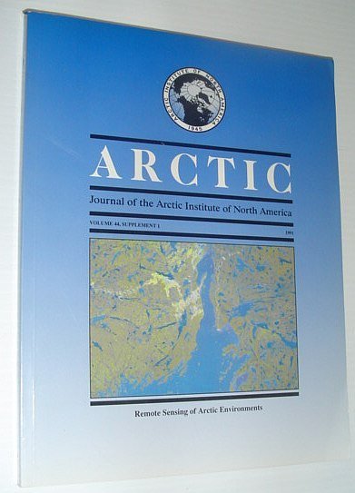
Arctic - Journal of the Arctic Institute of North America - Volume 44, Supplement 1, 1991 - Remote Sensing of Arctic Environments

The Arctic Institute of North America, 1991

99.95 €

RareNonFiction.com

(Ladysmith, Canada)

Ask for more info

Payment methods

Details

Year of publication
1991
Author
Mccullough, Karen M.: Editor
Publishers
The Arctic Institute of North America
Size
4to - over 9¾" - 12" tall
Edition
F First Edition
Keyword
Arctic - Journal of the Arctic Institute of North America -, Volume 44, Supplement 1, 1991 - Remote Sensing of Arctic Environments The Polar Oceans, Progarm of the Alaska SAR Facility, Remote Sensing and Geographic Information System Training, Requirements in Arctic Canada, Topographic Data and Satellite Spectral Response in Subarctic, High-Relief Terrain Analysis, Monitoring the Water Bodies of the Mackenzie Delta by Remote, Sensing Methods, Operational Remote Sensing of Sea Ice, Remote Sensing of the Sea Surface Temperatures for Aquaculture, Planning in Northern Norway, Remote Sensing of Permafrost by Ground-Penetrating radar at Two, Airports in Arctic Canada, Mapping Muskox Habitat in the Canadian High Arctic with SPOT, Satellite Data, Calibration of Aerial Thermal Infrared Imagery for Walrus, Population Assessment, Detection and Classification of Muskox Habitat on Banks Island, Northwest Territories, Canada, Using Landsat Thematic Mapper Data, An Assessment of Bison Habitat in the Mills, Mink Lakes area, Northwest Territories, Preliminary Geologic Interpretation of SAR Data, Yellowknife-Hearne Lake Area, Monitoring Natural Vegetation in Southern Greenland Using NOAA, AVHRR and Field Measurements, Satellite Geological Mapping of the Yellowknife Volcanic Belt, Measuring Climatc State Variables from SAR images of Sea Ice -, The SIMS SAR validation site in Lancaster Sound, The Role of Imaging Radar in the Development of the Canadian, Arctic - Background and applications, The Use of AVHRR Thermal infrared imagery to determine sea ice, thickness withing the Chukchi Polyna, In Situ Measurements of Micro-Scale Surface Roughness of Sea Ice, Derivation of Snow Water Equivalent in Boreal Forests Using, Microwave Radiometry, Lake and River Ice Investigations in Northern Manitoba using, airborne SAR Imagery, Location and Areal Extent of Polynyas in the Bering and Chukchi, Seas. Magazine Back Issues
Binding description
S Single Issue Magazine
State of preservation
Very Good
Languages
English
Binding
Softcover
First edition
Yes

Description

171 pages. Contents include: The Polar Oceans Progarm of the Alaska SAR Facility; Remote Sensing and Geographic Information System Training Requirements in Arctic Canada; Topographic Data and Satellite Spectral Response in Subarctic High-Relief Terrain Analysis; Monitoring the Water Bodies of the Mackenzie Delta by Remote Sensing Methods; Operational Remote Sensing of Sea Ice; Remote Sensing of the Sea Surface Temperatures for Aquaculture Planning in Northern Norway; Remote Sensing of Permafrost by Ground-Penetrating radar at Two Airports in Arctic Canada; Mapping Muskox Habitat in the Canadian High Arctic with SPOT Satellite Data; Calibration of Aerial Thermal Infrared Imagery for Walrus Population Assessment; Detection and Classification of Muskox Habitat on Banks Island, Northwest Territories, Canada, Using Landsat Thematic Mapper Data; An Assessment of Bison Habitat in the Mills/Mink Lakes area, Northwest Territories; Preliminary Geologic Interpretation of SAR Data, Yellowknife-Hearne Lake Area; Monitoring Natural Vegetation in Southern Greenland Using NOAA AVHRR and Field Measurements; Satellite Geological Mapping of the Yellowknife Volcanic Belt; Measuring Climatc State Variables from SAR images of Sea Ice - The SIMS SAR validation site in Lancaster Sound; The Role of Imaging Radar in the Development of the Canadian Arctic - Background and applications; The Use of AVHRR Thermal infrared imagery to determine sea ice thickness withing the Chukchi Polyna; In Situ Measurements of Micro-Scale Surface Roughness of Sea Ice; Derivation of Snow Water Equivalent in Boreal Forests Using Microwave Radiometry; Lake and River Ice Investigations in Northern Manitoba using airborne SAR Imagery; Location and Areal Extent of Polynyas in the Bering and Chukchi Seas. Clean and unmarked with light wear. Nice copy. Book